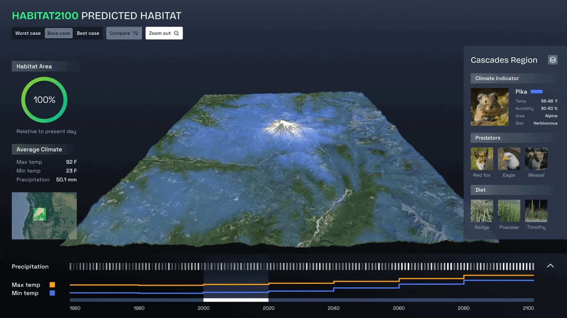
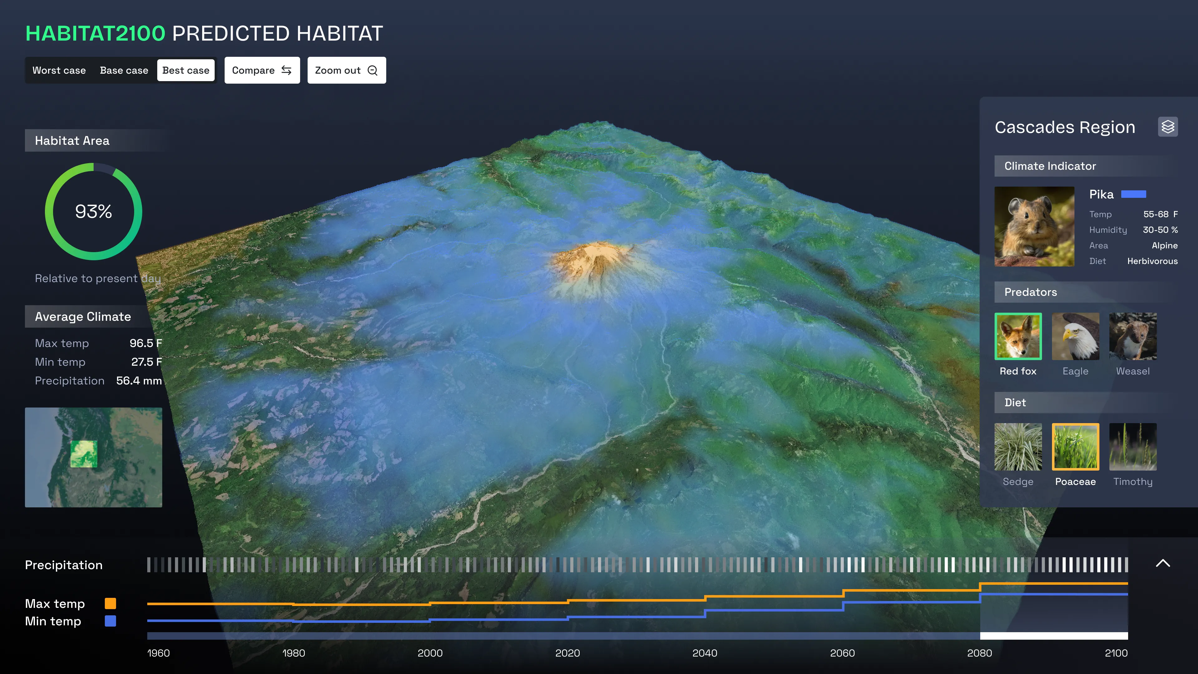
Habitat2100 is an interactive visualization tool that models how climate change might reshape where species can live. The system layers predictive habitat heatmaps onto an interactive 3D terrain, synthesizing climate projections, species occurrence data, and habitat modeling to show how ecosystems shift under different future scenarios.
Motivation
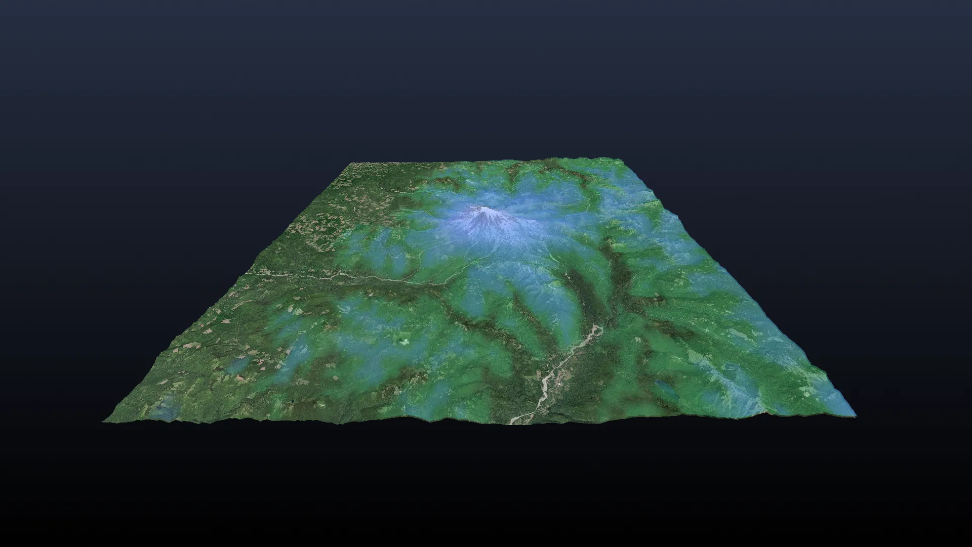
Tracking one species' habitat loss doesn't capture the full ecological picture — the ripple effects across interconnected species matter just as much. Habitat2100 visualizes these interdependencies, starting with the American pika (Ochotona princeps) and its ecosystem in North America's Cascades region.
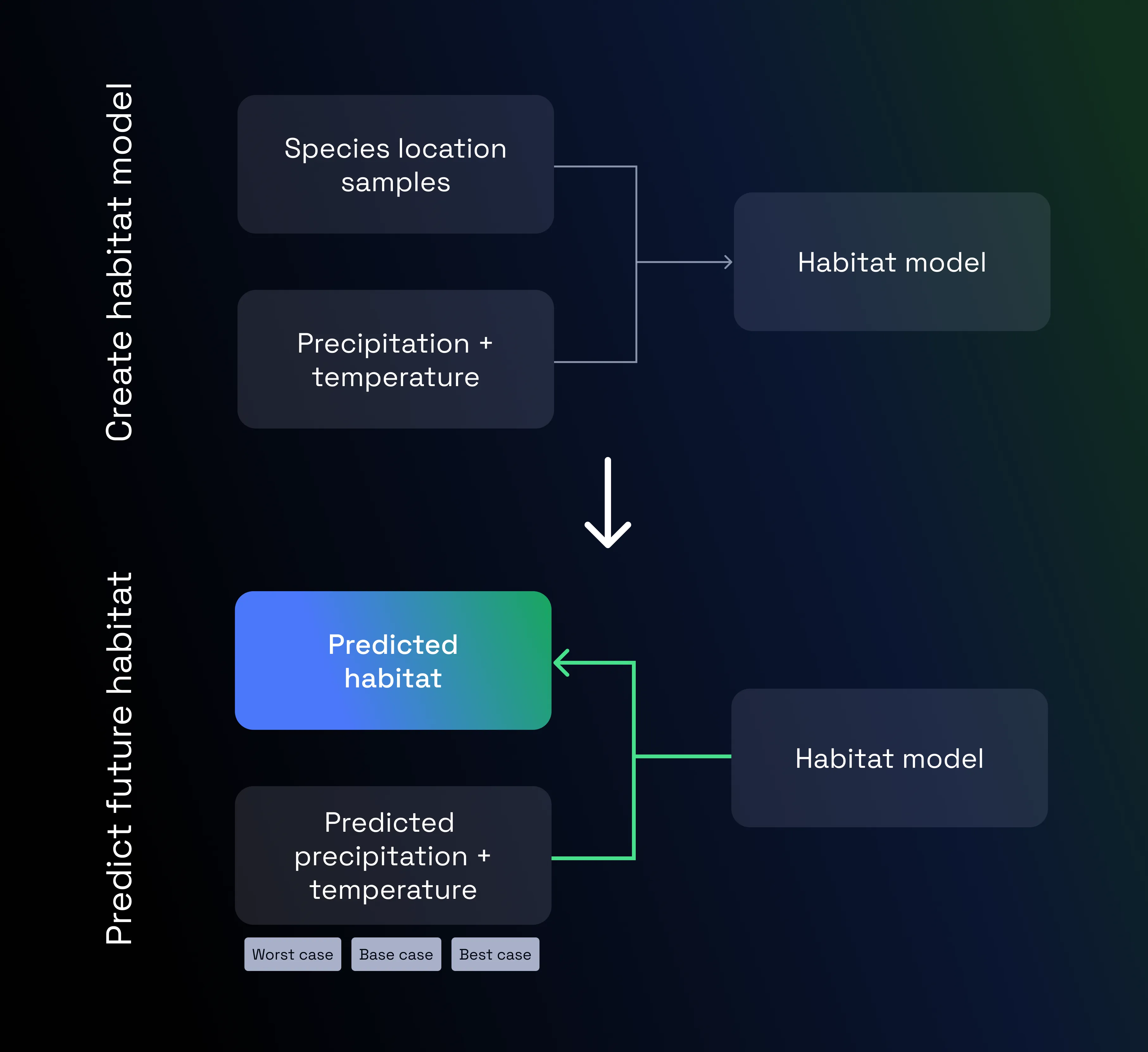
Predictive model diagram.
Ecological Modeling
The predictive model (Maxent) is trained on 50 years of historical climate data and species occurrence records, forecasting habitat suitability in 20-year intervals out to 2100. It draws from NASA climate projections across three scenarios — optimistic, moderate, and worst-case — to show the range of possible futures.
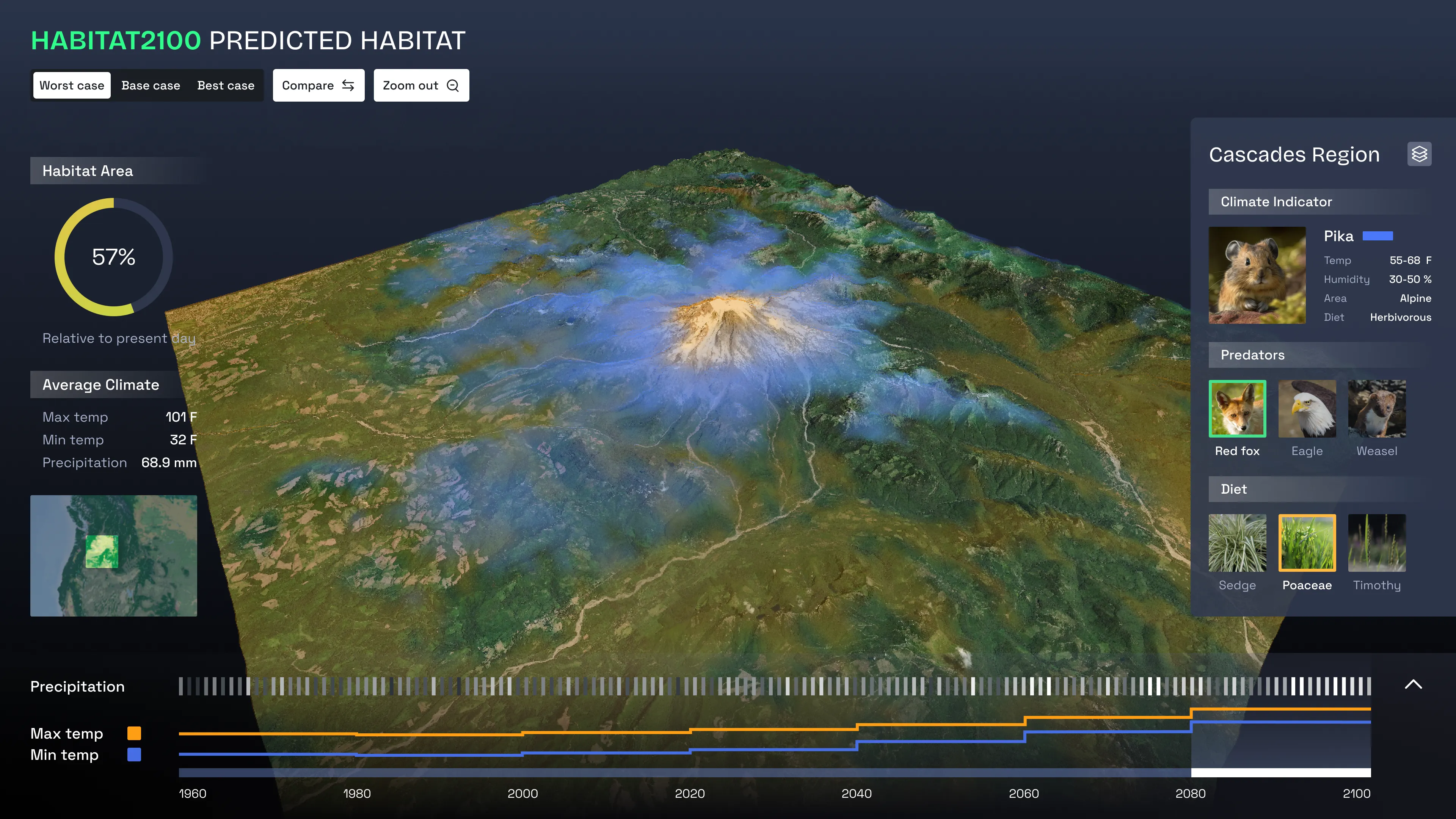
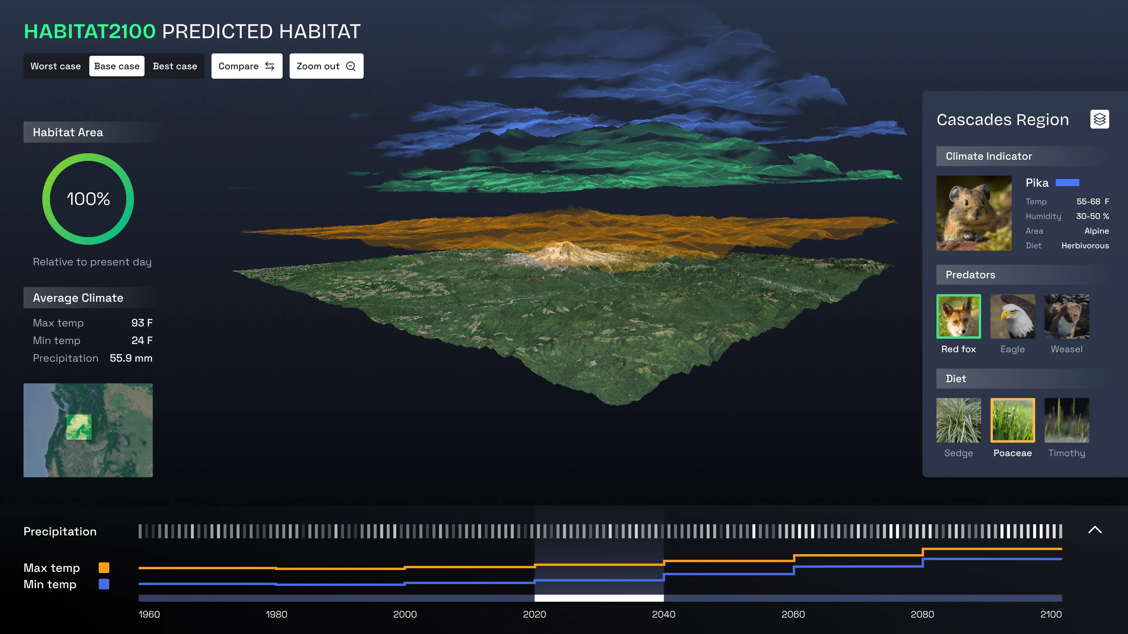
Each layer is a heatmap of the habitat suitability probability for a given species.
Interactive Analysis
Translucent heatmaps are superimposed on a 3D terrain, with distinct colors per species and opacity indicating suitability probability. Users can scrub through time periods, switch climate scenarios, toggle species layers, "explode" layers vertically for inspection, or compare two scenarios side-by-side — making it possible to ask questions like where a species' range might overlap with a predator's habitat under worst-case warming.